Recap
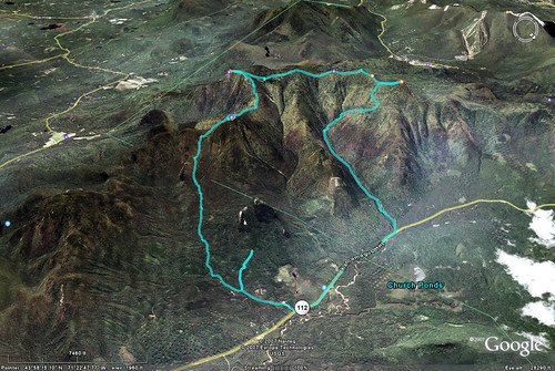
We started relatively early on Saturday morning and made our way down Oliverian Brook Trail, following the blue blazes. About a mile into the trail, it split off at a fork so we decided to turn right and keep following the blazes. Three quarters of a mile down that side trail we happened upon a large group of people standing at a fire road, scratching their heads. As we later figured out, we all had gone the wrong way by following the blue blazes! So, backtrack we did and that’s why on the GPS plot you’ll see a slight detour near the beginning of the trail.
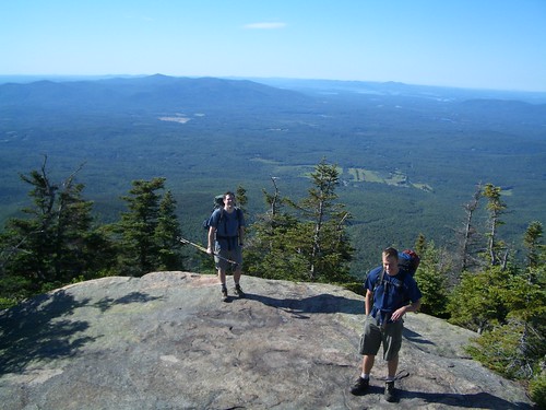
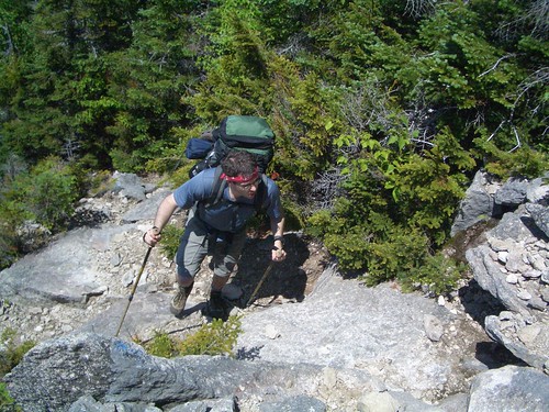
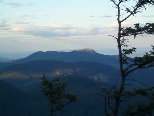
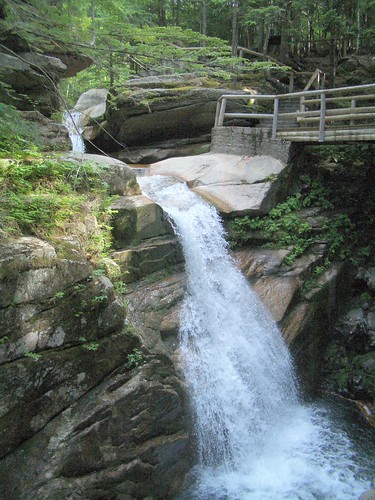
The rest of the trip went smoothly, though. The first day we hit Mt. Passaconaway and Mt. Whiteface, then camped near the summit of Whiteface at an old tent site called Camp Heermance (which is no longer maintained). On day two we walked across the Sleepers, then up the south slide of the Tripyramids. Dropping our packs where Tripyramid Trail meets Sabbaday Brook trail, we quickly bagged North Tripyramid, then made our way out the 6 miles back to the car. The last pasrt of the trail went right through Sabbaday Falls, which is an incredibly beautiful waterfall right off of Route 112.
After this 20+ mile trip, we were definitely ready for some Yankee Smokehouse on the way home!
Route
Day One
- Oliverian Brook Trail to Passaconaway Cutoff - 1.9 miles
- Passaconaway Cutoff to Square Ledge Trail - 1.7 miles
- Square Ledge Trail to Walden Trail - 0.7 miles
- Walden Trail over Passaconaway summit to Rollins Trail - 1.6 miles
- Rollins Trail over Mt. Whiteface summit to Camp Heermance - 2.4 miles
Day Two
- Rollins Trail from Camp Heermance to Kate Sleeper Trail - 0.1 miles
- Kate Sleeper Trail to Tripyramid Trail - 3.3 miles
- Tripyramid Trail over South and Middle Tripyramid to summit of North Tripyramid - 1.4 miles
- Tripyramid Trail to Sabbaday Brook Trail - 0.5 miles
- Sabbaday Brook Trail to Kancamagus Highway - 4.9 miles
- Kancamagus Highway to Oliverian Brook - 2.5 miles
Total: 18.0 miles
Pictures
Full gallery here.
Notes
- We hit every 4000 foot peak in the Sandwich Range on this hike