Recap
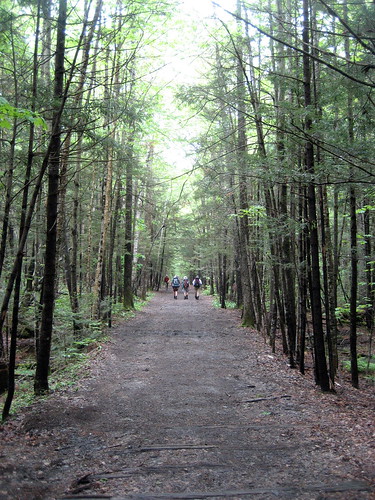
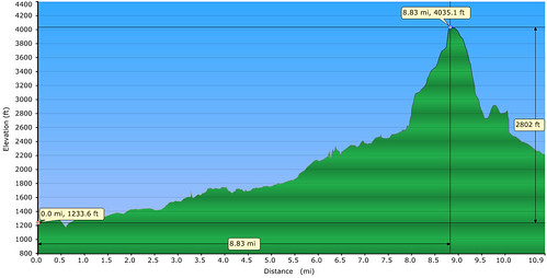
The majority of the hike in was flat, about 8 miles worth. Then it’s straight up the mountain: 1500 feet in one mile or so. We were chasing the clock, so we went as fast as we could. It was brutal. Fun, though!
Route
Day One
- Lincoln Woods Trail to Black Pond Trail - 2.6 miles
- Black Pond Trail from Lincoln Woods Trail to Black Pond - 0.8 miles
- Bushwhack from Black Pond Trail to Lincoln Brook Trail - about 1.0 miles
- Lincoln Brook Trail from bushwhack to trailside camp - 1.3 miles
- Lincoln Brook Trail from trail-side camp to Owl’s Head Path - 1.5 miles
- Owl’s Head Path from Lincoln Brook Trail to Owl’s Head summit - 1.1 miles
- Owl’s Head Path from Owl’s Head summit to Lincoln Brook trail - 1.1 miles
- Lincoln Brook Trail from Owl’s Head Path to trailside camp - 1.5 miles
- Day One Total: 10.9 miles
Day Two
- Lincoln Brook Trail from trailside camp to bushwhack - 1.3 miles
- Bushwhack from Lincoln Brook trail to Black Pond - about 1 mile
- Black Pond Trail from Black Pond to Lincoln Woods Trail - 0.8 miles
- Lincoln Woods Trail from Black Pond Trail to parking lot - 2.6 miles
- Day Two Total: 5.7 miles
Total: 16.6 miles
Bushwhack
This page has gotten a lot of hits from people looking for the Black Pond bushwhack, so I I’ll dedicate a little space to that. First thing’s first, I do recommend doing this rather than walking the extra miles and having to cross the river three or four more times, especially in the Spring when the river is running fast and deep. However, make sure that you have a map, a compass, and a GPS if at all possible.
Once you get to Black Pond, there’s a little clearing with some rocks and you’ll notice that the trail seems to continue. This is the start of the bushwhack. This method of reaching Owl’s Head is so popular that for the first half mile or so the bushwhack actually looks like a real trail. In fact, when we were there, someone had started marking the bushwhack with orange blazes. We started out following the blazes from Black Pond, but eventually lost them about three-quarters of the way, once the “trail” started going away and the trees started thinning out a little. At that point we relied on our maps and GPS to get us the rest of the way.
The whole time we had our GPS running so we got tracks of the entire thing. I’ve included these for download below. Before we went I had looked for some GPS tracks of the bushwhack but was unable to find anything. Also included in these tracks is the way up the mountain, which is also kind of bushwhack in itself. Hopefully, these tracks will help someone. For the bushwhack, use our Day Two track – Day One was when we lost the blazes and had to go follow the river to meet back up with the trail. On Day Two we had the advantage of knowing where we’d been so we could travel in a much more direct route through the bushwhack.
Video
Pictures
Full gallery here.
Notes
- Did the bushwhack from Black Pond to Liberty Brook Trail – recommended in order to avoid river crossings


